LegalDroneWA.com
For contractors, owners & developers

MEP Documentation

Document the work before it gets covered.
Drone footprint and progress photos plus Realsee P4 ground 3D LiDAR scans, from existing conditions through closeout.
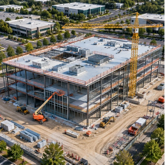
Illustrative imagery. Aerial photos are captured by camera drone; LiDAR scans are captured from the ground.
Dated photos. Measurable scans. Lasting records. Once drywall goes up, the rough-in is gone.
Watch: 68 seconds

How we document your project.

Drone footprint, progress flights, Realsee P4 LiDAR before and during work, open-wall MEP takeoffs, as-built CAD and the finished record.

Illustrated animation. Dimensions and takeoff quantities shown are examples, not project data.
One record, start to finish

Six phases. Book only what you need.

Every visit is dated and GPS-tagged, and progress shots are flown or scanned from the same positions each time, so each set lines up with the last.

Illustrative aerial construction view for site documentation
PHASE 01

Drone shot of the footprint

A mapped aerial baseline of the lot, staking, access, laydown and neighboring property before work starts. If the project is small or fully interior, skip it.

Once, at mobilization
Illustrative aerial view of construction progress
PHASE 02

Progress photos

Repeat drone flights from saved waypoints, same altitude and angle every visit. Use them for pay applications, owner and lender updates, schedule disputes and subcontractor coordination.

Daily, weekly or monthly
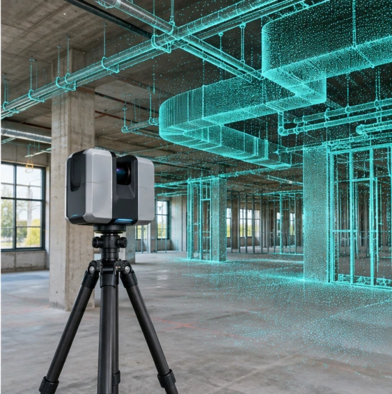
Illustrative ground LiDAR scanner and point-cloud view
PHASE 03

3D LiDAR: before and during

The Realsee Galois P4 records existing conditions in a walkable 3D tour with a measurable point cloud. Scan again at key milestones to show what changed and when.

Before work, then at milestones
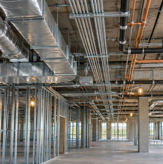
Illustrative exposed mechanical piping, ductwork and framing
PHASE 04

Open walls: MEP takeoffs

A dense scan of every open bay at rough-in. Measure pipe, duct and conduit runs, box heights and penetrations from your desk. Add a takeoff report that lists runs wall by wall for estimating, change orders and closeout.

Last chance before drywall
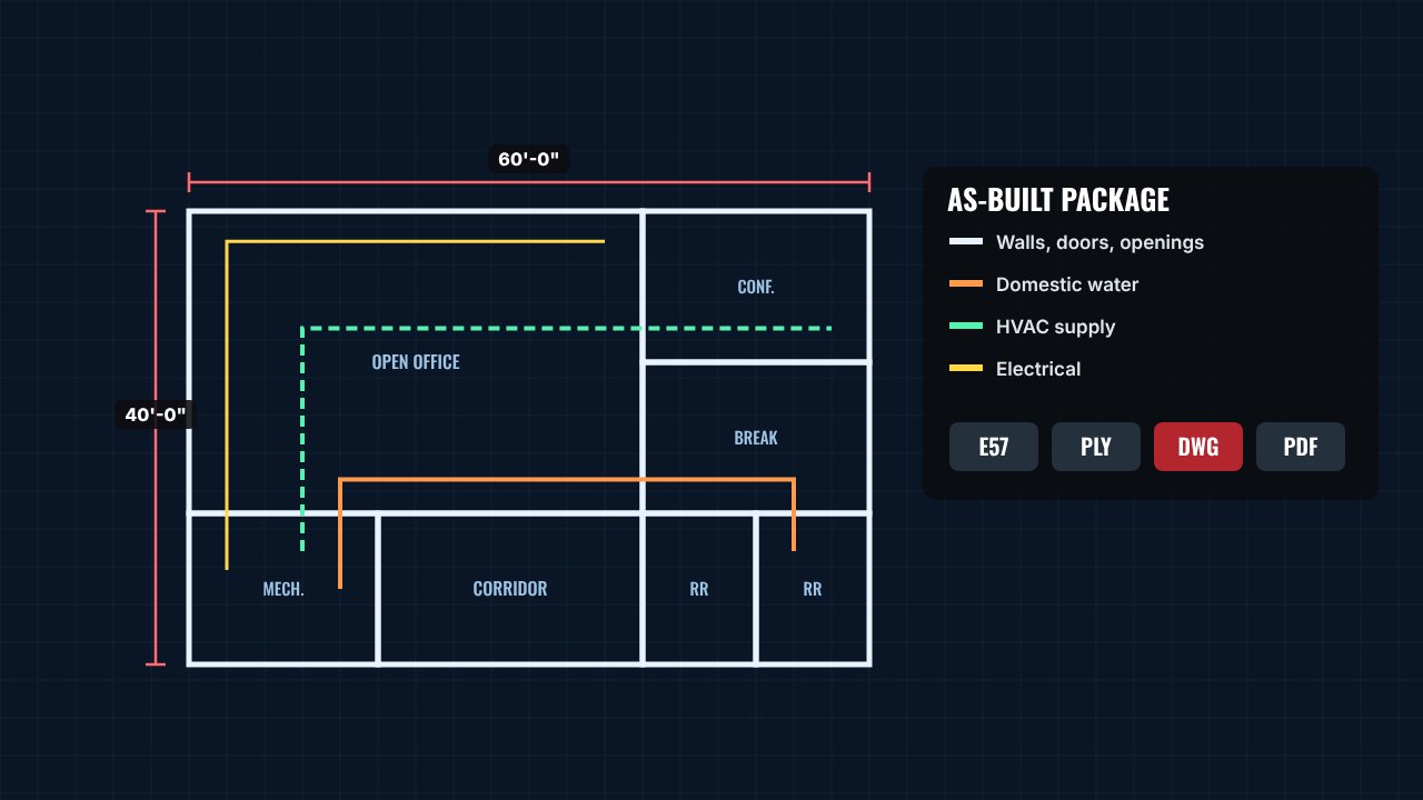
Illustration: floor plan drawn from a point cloud with walls, domestic water, HVAC and electrical layers and E57, PLY, DWG and PDF file types
PHASE 05

As-builts

The point cloud becomes your as-built record: E57 and PLY point clouds for Revit and AutoCAD, a floor plan, and optional DWG drafting with MEP layers.

At rough-in or substantial completion
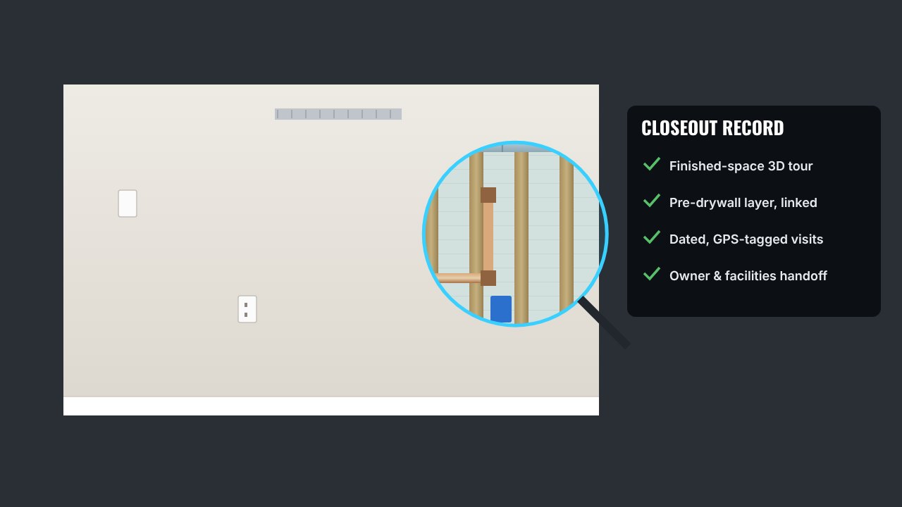
Illustration: finished painted wall with a magnifying lens revealing the pipes and wiring recorded behind it
PHASE 06

Finished product

A 3D tour of the finished space, linked to the open-wall scans. Facilities staff and future trades can see what's behind each wall before they cut.

At closeout
Plan your documentation

Services & pricing

Choose the phases your project needs. Final scope and pricing are confirmed in a written quote.

ServiceRate
Open walls & MEP takeoffsOptional takeoff report: + $0.13 per sq ft$0.56 per sq ft
Drone footprint baseline$815
Monthly drone progress visit$565 per visit
As-built documentationOptional DWG drafting: + $0.31 per sq ft$0.44 per sq ft
Existing conditions before work$0.25 per sq ft
Closeout documentation$0.19 per sq ft
Project minimum · drone only or LiDAR only
$1,250
Project minimum · drone + LiDAR
$2,500

12-month agreement: 20% off visits. Prices exclude sales tax.

Project minimums apply to the overall project; the individual service rates above are not standalone minimum charges.

For multifamily developers & builders

Several sites. One consistent monthly record.

Investors, lenders and owners want the same view every month. Each site is flown on its own saved flight plan, and the report comes out in the same format every time, ready to upload to your investor portal.

Monthly investor report

A mapped aerial of the whole site, an angled orbit of every building, a short progress video and a one-page PDF with the date and what changed.

Pre-drywall, unit by unit

Scan every unit's open walls at rough-in. Years later, a leak or warranty call starts with the scan, not a saw.

Frontage & right-of-way

Dated aerials of road frontage, sidewalks and off-site improvements as they're built: proof of what was installed, and when.

Lease-up & sales

Aerial hero shots, a short video and a walkable 3D tour of the model unit, ready for leasing and listing pages.

Who uses it

Built for the people who get the call.

MEP contractor

Takeoffs and change orders

Measure runs from the scan instead of a tape. Show exactly what was installed before the walls closed, and back up every change order with a dated record.

General contractor

Pay apps and schedule

Same-angle progress photos for pay applications, owner meetings and lender draws. Settle "when was that done?" with a date stamp.

Owner / facilities

Know what's in the wall

Find a valve, drain or junction box before cutting. Plan the next remodel from real conditions instead of the design drawings.

Developer / investor relations

Portal-ready every month

The same views, the same format, on the same schedule, for every site. Investors see progress without a site visit.

Project manager

Fewer site trips

Walk the job in 3D from the office. Check rough-in, clearances and penetrations, and send a link instead of driving out.

How booking works

Four steps.

Call & scope

Tell us the address, square footage, schedule and which phases you need. We send a written quote.

Baseline

Drone footprint and before scans on the first visit. Certificate of insurance before we start.

Scheduled visits

Progress flights and scans on your calendar. Call us when walls are ready to close for the MEP scan.

Delivery

A shared link to photos, 3D tours and files, organized by date, plus downloadable E57, PLY and CAD files you keep.

Who documents your job

We've run MEP work.

LegalDroneWA.com is run by a former mechanical contractor project manager, estimator and safety director, with an MCAA mechanical project management certification. He is also a U.S. Army veteran, a retired police officer and a certified construction health and safety technician. We know what an MEP takeoff needs because we've built them.

Veteran OwnedFAA Part 107 Certified PilotCHSTMCAA Mechanical PMGig Harbor, WA

The gear: Realsee Galois P4

  • 905 nm LiDAR, about 125,600 points per second
  • About ±10 mm measurement error at 0.1–15 m (manufacturer spec)
  • Up to 100 m range, 360° capture
  • Exports E57 and PLY point clouds, floor plans and CAD-ready files
  • Paired with a camera drone for aerial footprint and progress work
Before the walls close

Get your project on record.

253-888-3432

Call or text · rbd171@gmail.com · Serving King, Pierce, Thurston and Kitsap counties